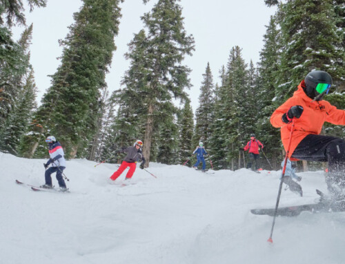
In early December, more than 35 resorts in British Columbia, Alberta, Ontario, and Quebec were up and running, and by mid-month dozens more are expected to be operational. Among the early openers were Apex, Cypress Mountain, Whistler-Blackcomb, Fernie Alpine and Lake Louise in the west, Mount St. Louis Moonstone in Ontario, and Tremblant in Quebec.
On December 8, Apex Mountain in Penticton, reported 46 inches of packed powder at both the base and summit with all 80 trails and all four chairlifts open; at Fernie, skiers and boarders were enjoying more than 32 inches of packed powder with 77% of trails and seven of 10 chairs running. At Ontario’s Mount St. Louis Moonstone, there was four to 16 inches of machine-groomed snow and eight of 36 trails, and three of 12 lifts were open. Tremblant reported 27 inches of machine-groomed snow and 17 of 102 trails and six of 14 chairs serving skiers and boarders.
In addition to a string of early openings, resort owners should also be buoyed by long range weather forecasts that are calling for a cold and snowy winter, particularly in Western Canada. The extended winter weather forecast from the Farmer’s Almanac has this to say:
“Got flannel? Hot chocolate? Snowshoes? If not, you may want to go get some. According to our extended forecasts, 2022-2023 will be remembered as a time to shake, shiver, and shovel—a winter season filled with plenty of snow, rain, and mush as well as some record-breaking cold temperatures!”
The Almanac’s experts (https://www.farmersalmanac.com/canadian-extended-forecast) predict the following:
- The winter season will be quite stormy for most areas. An active storm track will travel across eastern North America from the western Gulf of Mexico to the northeast, across the New England region of the US and up into the Maritime Provinces, giving the Maritimes a good number of cold rains and storms filled with snow, sleet, ice, and rain. Areas to the north and west of this active track, Labrador, Newfoundland, Quebec, Ontario, and the Great Lakes, will more often-than-not will see winter’s precipitation fall as snow, and sometimes a lot of it.
- The Prairie Provinces will be hardest hit, with tons of snow in both January and February.
- British Columbia should see about average amount of winter precipitation, but with brisk temperatures, skiing should be decent.
- Many significant weather disturbances will cross the nation, but we are raising “red flags” for the first week of January across the Rockies and Prairies, with the potential of heavy snows, followed by bitter cold air.
- From January 16 to 23, 2023, across the eastern two-thirds of the country, bouts of heavy snow and rain are expected, followed by what might be one of the coldest outbreaks of arctic air in many years – as cold as -40° C.
- After the vernal equinox on March 20, expect a lion-like end to March with a wide variety of weather ranging from heavy snows to torrents of rain, to gusty thunderstorms and stormy weather across much of the nation.
Bring on winter!
Featured Image By: Denys Nevozhai